GPS Connectivity Status
Discover GPS connectivity status area icon meanings.
Updated March 26, 2021
GPS Connectivity and Speed
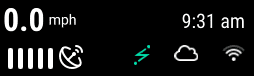
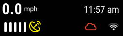
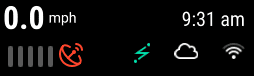
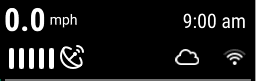
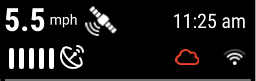
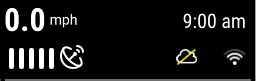
The top right-hand corner of the home screen displays the current speed of the tractor. The bars under the speed source icon indicate signal strength.
Icon colors indicate:
- White indicates speed source connectivity is good.
- Yellow indicates communication is lost momentarily, there are errors in the signal, or the GPS signal is lost.
- Red indicates the speed source is unusable.
There are four different icons that can be displayed:
- GPS receiver icon - This indicates the speed source is coming from the GPS system.

- Tractor or radar icon - This indicates the speed source is coming from the radar system.

- A capital “R” inside of a box - This indicates the tractor is moving in reverse.

- Satellite icon - This indicates that the vehicle is moving and speed is coming into the GPS System.

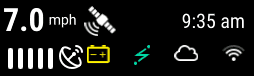
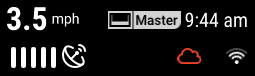
Yellow Battery Icon
The yellow battery icon will apear when voltage to the Display Base Module (DBM) is powering off. This means that either the push button on the DBM is turned to off or the vehicle is powering off.
WiFi and Cloud Icons
A WiFi icon will apear when you have succesfully connected to a WiFi hotspot. Once connected to WiFi you will be able to login to 20|20 Cloud. Click here to learn more about conecting to WiFi and 20|20 Cloud
- A white cloud symbol will appear in the GPS button once the system has authenticated your cloud login information.
- A red cloud symbol indicates that the cloud is not currently connected. This could be due to a poor WiFi connection.
- A yellow line cloud symbol indicates that is connected however cloud backup is disabled on the 20|20 Cloud setup page.
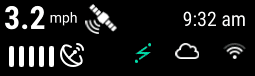
Green Lightening Bolt Icon
A green lightening bolt will appear when 20|20 Connect is connected to the 20|20. Click here to learn more about 20|20 Connect
Saftey Mode Icon
The Saftey Mode icon will appear if you have not cleared the Safety Warning when the 20|20 turns on. Click here to learn more about the safety warning
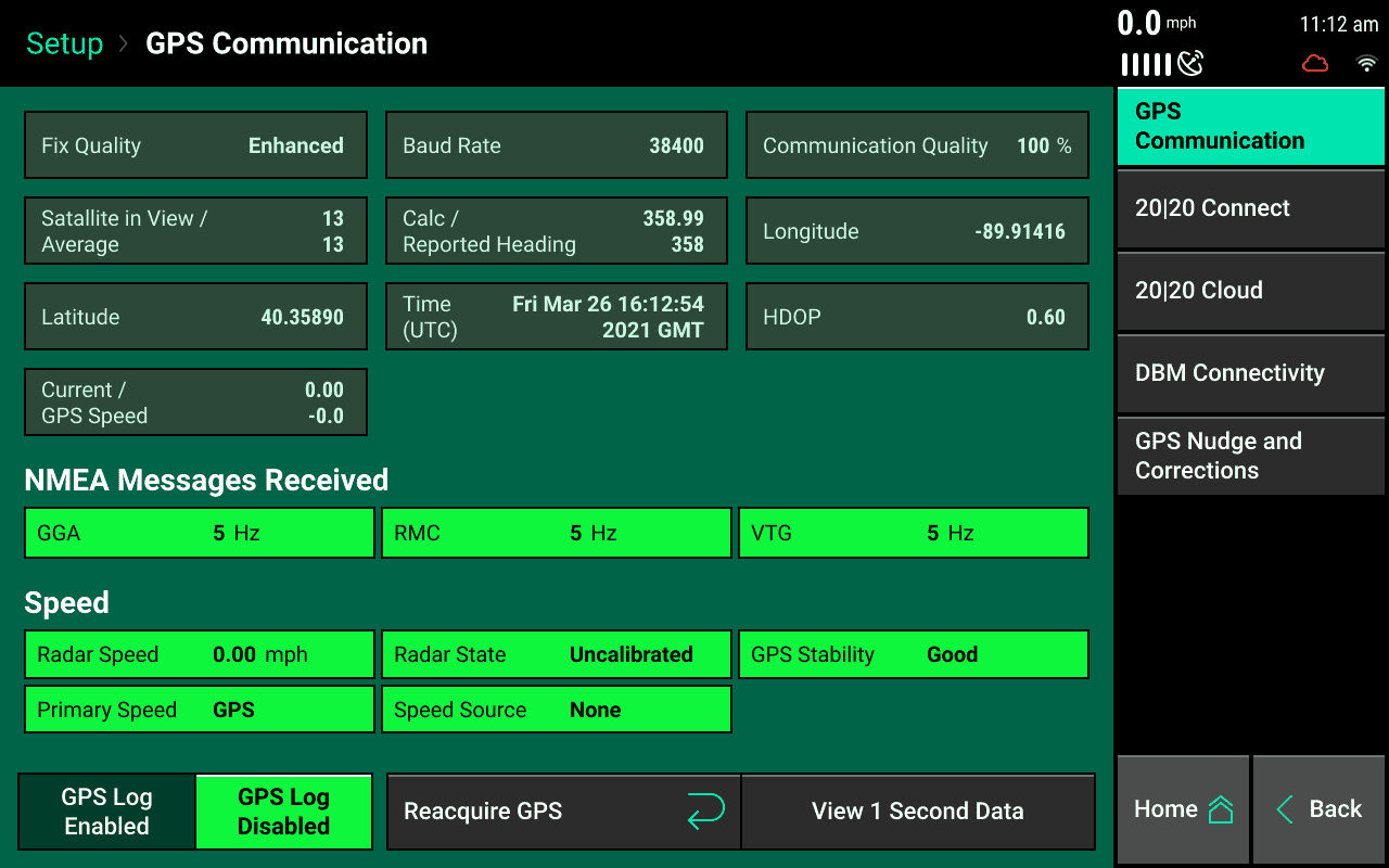
GPS Communication
Navigate to GPS communication by pressing the speed button in the top right-hand corner of the home screen.
For best GPS results:
- Set the Baud Rate to 19200 or 38400 in the system outputting the GPS.
- The communication quality should be as close to 100% as possible.
- There should be at least three satellites within view.
- The HDOP should be between 0 – 2.
- Set NMEA messages GGA, RMC (or ZDA), and VTG at 5 Hz in the system outputting the GPS. Additional NMEA messages may degrade the GPS information with too much information.
GPS communication
GPS logs may be enabled at the bottom of the page if requested by Precision Planting Support. Press the “Reacquire GPS” button at the bottom of the screen to try to reacquire the GPS signal.
GPS Nudge and Corrections
Configure how the system handles the GPS signal.
Do not change any of the GPS correction settings unless instructed to do so by a Dealer or Precision Planting Product Support.
Bad GPS correction Change between calculated and GPS speed. Use calculated for lower-grade GPS systems.
Heading mode Change between calculated and GPS. Use calculated for lower-grade GPS systems.
Correction level Change from normal to high. High correction level will raise the minimum GPS quality percentage for mapping.
Primary packet Switch between GGA and RMC for the primary NMEA packet.
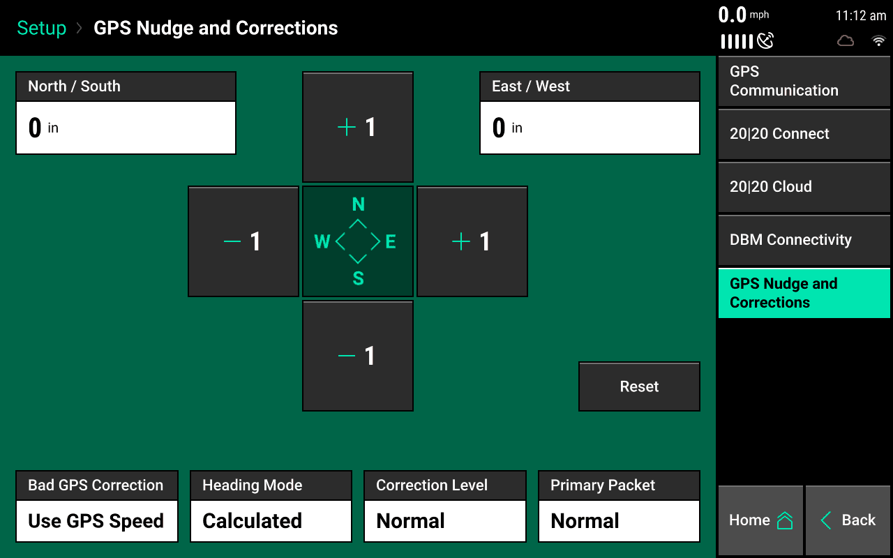
GPS nudge
Use to move the map data in situations where GPS shift has occurred. Use the +1 buttons to nudge the map in that direction.